An interactive visualization platform to accelerate early stage screening
↓
What is Pixel?
Geographical constraints and business case analytics merged for holistic project location screening
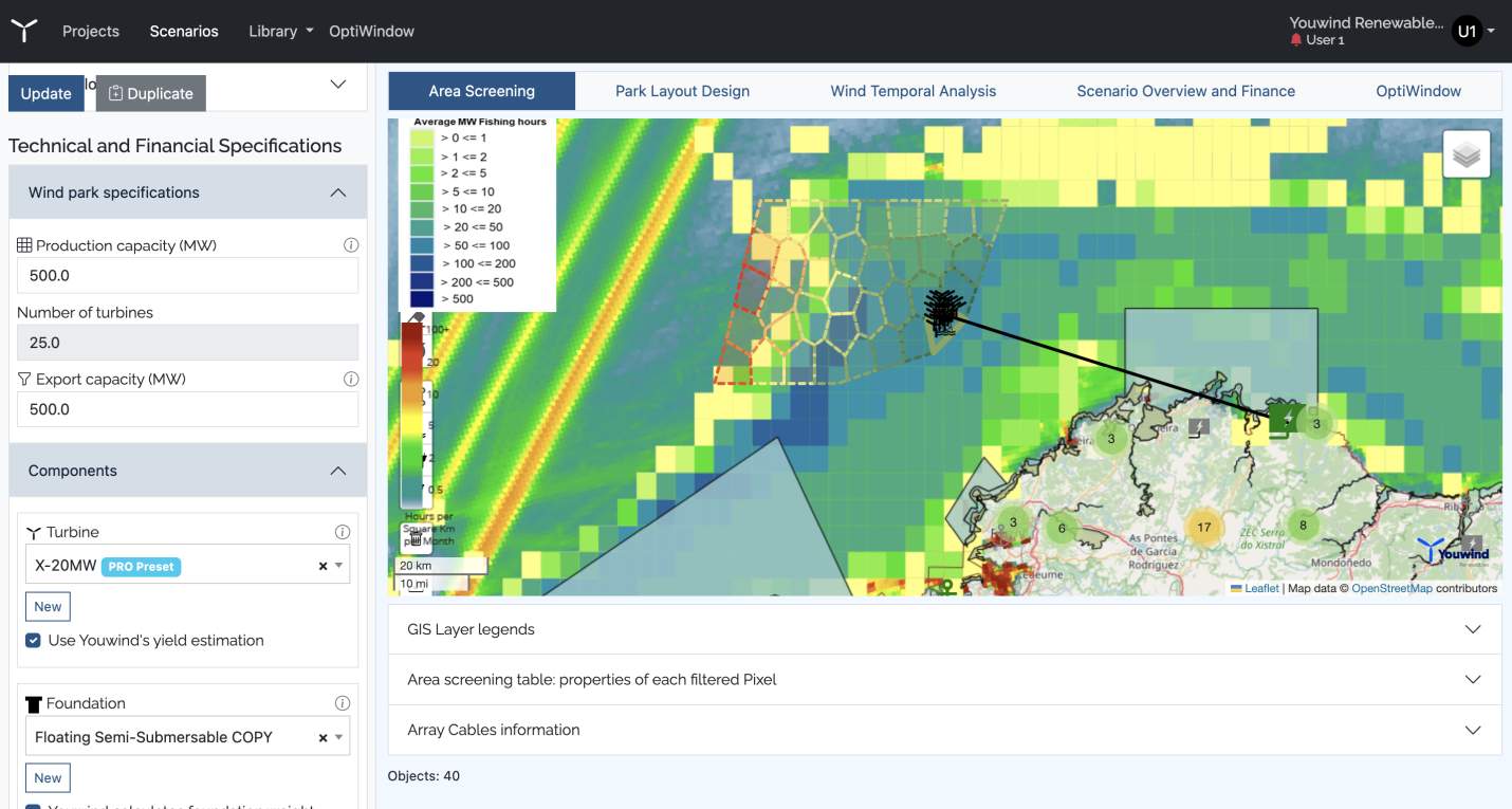
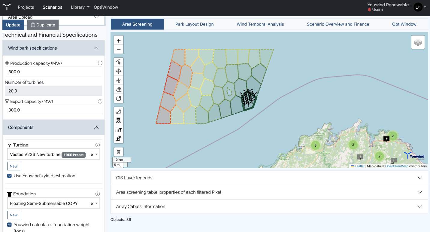
Pixel is a disruptive web-based visualization platform that creates accurate LCoE heat maps for any wind farm configuration and sea area. It also includes an extensive library of Geographic Data Layers for powerful GIS analytics to consolidate environmental and technical contraints.
With the best LCoE heat maps on the market, Pixel has been demonstrated to reduce early-stage screening time by up to 80%.
UNDERSTAND PARK PERFORMANCE IN ANY SEA AREA
Calculate the key technical and financial features of your wind project and replicate it for any sea area, quickly and accurately
STAKEHOLDER MANAGEMENT (GIS)
Use Youwind’s GIS preset data library or extend it with your own GIS layers to deep dive on environmental and technical constraints for identified best development areas
SCREEN FASTER WITH THE BEST LCOE HEAT MAPS
Generate the best LCoE or IRR heat maps on the market – combining GIS analytics with Youwind’s calculation power
STAY SECURE
Benefit from the highest standards of confidentiality to protect your project’s data
LEARN FROM THE EXPERTS
Draw on constant support from our experts with more than 15 years of experience in the market.
Why use Pixel?
The pressure has never been greater to increase the deployment of new offshore wind projects worldwide – but the industry faces significant challenges in realizing this growth.
Youwind empowers development teams and bridges the gap by providing the tools they need to work faster and more effectively.
How does Pixel work?
Pixel helps users identify where their wind farm will perform best in technical and financial terms within any chosen sea area polygon – generating an LCoE heat map at staggering speed.
Pixel also has the GIS analysis capabilities to combine all relevant constraints and identify feasible development areas – based on our own GIS library and layers directly uploaded into Pixel by users.
Giving users the ability to undertake multi-criteria analysis within a few clicks, Pixel is the best-in-class app for accurate early-stage project Screening.
Know more about Pixel
FAQ
Am I going to receive technical support during the Project Pilot or Annual Subscription?
Yes, during the Project Pilot or Annual Subscription you are going to receive IT support and offshore wind expertise support following the onboarding procedure. Technical support based on IT functionalities is included throughout the duration of your contract.
Can we add specific weather data in Optiwindow?
Yes, it is possible to add specific weather data in our logistic planner such as wind speed at harbour and wind/wave data at the site through “Edit weather data” on the Activity Section of Optiwindow.
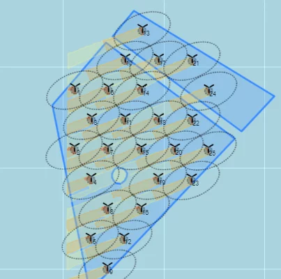
How are the Pixel/subareas defined when screening the area?
When screening your area with Pixel, you can set the wind farm density which is the power capacity (MW) divided by the area (km2) and with the power capacity, Pixel app will split the designated area into different small sub-areas called “pixels”.
Trusted by