
Geospatial Intelligence for Floating Offshore Wind Farms: Expanding the Horizon
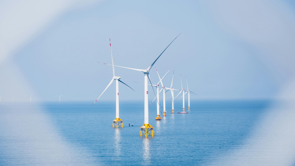
The Rise of Floating Offshore Wind
As the offshore wind farm industry extends into deeper and more complex marine zones, floating offshore wind has emerged as the enabler for markets previously constrained by seabed limitations. It opens access to stronger, steadier wind resources—but also brings new layers of uncertainty in site selection, design, and regulation.
Unlike fixed-bottom projects, floating wind farms require far more dynamic and granular analysis, especially at the earliest stages of planning. Here, geospatial intelligence becomes not just valuable—it’s essential for robust decision-making and bankable outcomes.
Complex Challenges Demand Smarter Mapping
Floating turbines can be positioned far from shore and in deep waters. But this flexibility introduces heightened spatial and environmental complexity. Developers must navigate:
- Wave height, ocean dynamics, and marine current modeling
- Seabed variability that affects mooring and anchor suitability
- Regulatory overlays such as shipping corridors, military zones, or fisheries
- Ecological and weather-related risks in ever-changing ocean environments
All of these are moving variables. That’s why scenario comparison for wind farms, informed by accurate and multi-layered GIS constraint analysis, is critical from the outset.
Youwind’s Platform: Purpose-Built for Floating Wind
To address these needs, Youwind integrates a suite of floating-specific geospatial intelligence tools within its early stage screening environment.
Formerly known as Pixel+, this module now enables developers to:
- Conduct wind resource assessment with marine traffic, bathymetry, and environmental overlays
- Evaluate seabed anchoring suitability and wave energy dynamics
- Streamline project approvals by reducing early-stage uncertainty
- Optimize the wind farm layout in real time with spatial constraints and wake loss modeling
These tools are part of a seamless wind farm planning tool that enhances precision and accelerates early risk mitigation for floating wind developments.
From Complexity to Confidence
One of Youwind’s core strengths is enabling developers to act with clarity early—when it matters most. By offering a consolidated geospatial overview, the platform empowers teams to:
- Map and quantify technical and regulatory constraints
- Run layout variations using integrated platform logic for deeper sites
- Embed environmental restrictions directly into bankable yield assessment strategies
In floating projects—where delays due to spatial misalignment can derail entire phases—this capability is critical for project viability and investor confidence.
Floating offshore wind is not only a technical leap—it’s a strategic one. The success of these projects relies on making data-driven decisions in wind energy from day one.
With Youwind’s platform, developers access expert-backed, geospatially informed insights that transform uncertainty into opportunity. The result: smarter development, shorter lead times, and more resilient projects built to perform in the world’s most demanding waters.
Request a demo
Get a first-hand look at how Youwind can support your wind energy management and development, whether onshore or offshore. Fill out the form and we’ll be in touch to schedule your personalised demo.
Related Knowledge
 April 2, 2026
Youwind Newsletter April 26 Edition
Welcome to the April edition of the Youwind newsletter Each month, we’ll bring you the latest key developments in wind project design, product updates from our platform, company news, and a look at what our team has been working on. You’ll also find upcoming webinars,…
 March 5, 2026
Youwind Newsletter March 26 Edition
Welcome to the March edition of the Youwind newsletter Each month, we’ll bring you the latest key developments in wind project design, product updates from our platform, company news, and a look at what our team has been working on. You’ll also find upcoming webinars,…
 February 24, 2026
Youwind leads the shift to hybrid wind power plant design with storage
The first SaaS platform integrating BESS and H₂ into wind farm design from early-stage project development is a reality The energy transition is accelerating, and with it the complexity of renewable power plants. Wind farms are, especially for onshore, no longer developed as standalone generation assets — they are increasingly…