
GIS Spatial Data for Smarter Wind Farm Planning
In the development of any offshore wind farm or onshore wind farm, spatial data isn’t just helpful, it’s fundamental. From early-stage site screening to late-stage permitting and financing, developers need accurate, high-resolution geospatial intelligence to evaluate constraints, reduce risk, and accelerate time-to-build.
At Youwind, we’ve built one of the most advanced GIS environments in the wind sector, designed not only to centralize vast amounts of geographic data but to make that data actionable, interoperable, and fully integrated into every key decision.
A Scalable, Transparent GIS Foundation
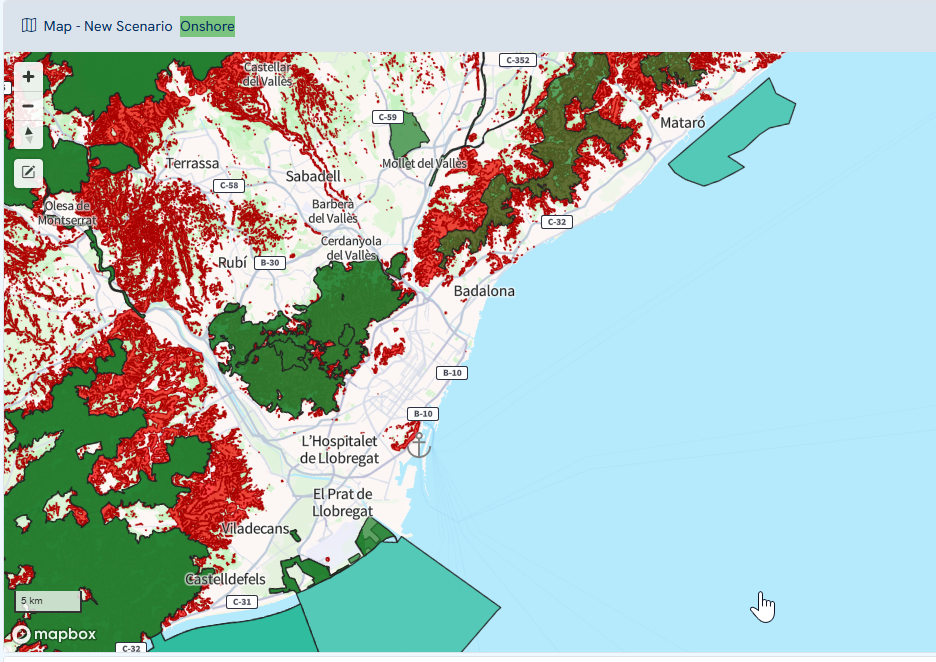
Our platform provides direct access to a vast and continuously expanding library of spatial datasets, tailored to the specific needs of wind farm development. Whether you’re assessing feasibility or optimizing layout, our data foundation helps surface critical insights early in the process. The most significant layers being:
The Climatic & Environmental Layers:
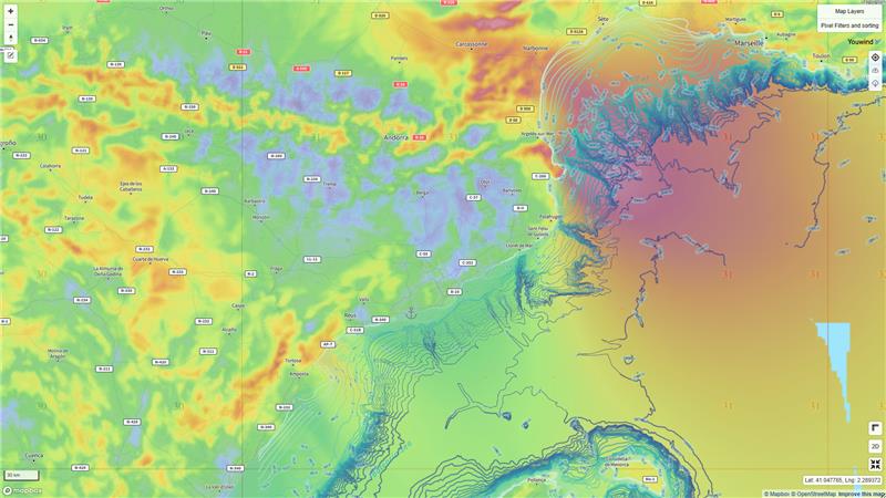
- Mean wind speed (crucial for wind resource assessment)
- Bathymetry (critical for offshore siting)
- UTM zones and other geographical boundaries
The Constraint & Regulatory Layers:
- Protected and restricted areas
- Slope analysis (e.g., >10° or >15°)
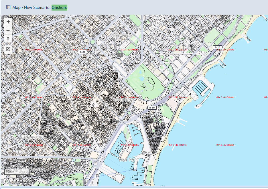
- Land parcel information
- Onshore infrastructure: boreholes, substations, and power lines
Each layer is accompanied by metadata including source and last update, reinforcing transparency and ensuring users can trust what they see. This is essential for developers conducting bankable yield assessments or preparing projects for financing and permitting.
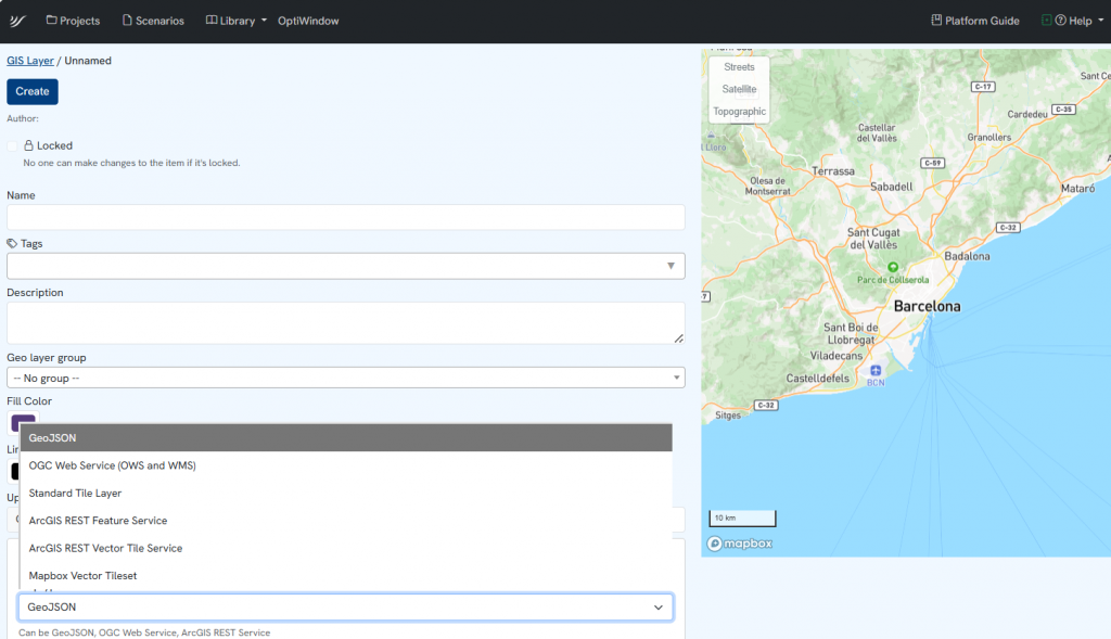
Integrate Your Own Data, Your Way
We know that every developer brings unique context and proprietary knowledge. That’s why Youwind enables full compatibility with industry-standard GIS formats, allowing you to upload, overlay, and manage your own datasets within our interface:
- GeoJSON/Keyhole Markup Language (KML)
- Web Map Service (WMS)
- Standard Tile Layer (XYZ)
- ArcGIS REST services
These integrations make it easy to incorporate site-specific constraints, community feedback, or engineering preferences directly into your wind farm layout and GIS constraint analysis workflows. With real-time updates and centralized version control, your team always works with the most recent data, no more scattered files or outdated maps.
We are continuously expanding, broadening the range of tools and data sources you can integrate seamlessly into Youwind.
Design Smarter with Constraint Mapping Tools
Built-in design tools allow users to define and flag restricted areas based on spatial rules or visual inputs, automating the identification of no-go zones such as steep terrain, sensitive habitats, or exclusion buffers around settlements and infrastructure.
These features are invaluable during early-stage screening, allowing users to filter out unsuitable areas and focus development efforts where conditions are favorable. This leads to faster, more confident go/no-go decisions and avoids costly redesigns down the line.
Built for Integration, Backed by Expertise
The GIS module is part of our integrated platform, which combines geospatial intelligence with:
- Financial modeling for wind energy
- Scenario planning and optimization
- Layout tools that account for wake loss modeling and neighboring constraints
- API integrations with trusted providers like Vortex
This seamless ecosystem supports data-driven decisions in wind energy, from early-stage analysis to investment-ready outcomes.
Final Takeaway: Bankable Insights Start with the Right Layers
When every hectare matters, so does every dataset. Youwind’s GIS environment equips your team with a unified, constantly updated view of constraints, risks, and opportunities, empowering smarter decisions and faster progress across all wind farm projects.
Request a demo
Get a first-hand look at how Youwind can support your wind energy management and development, whether onshore or offshore. Fill out the form and we’ll be in touch to schedule your personalised demo.
Related Knowledge
 March 5, 2026
Youwind Newsletter March 26 Edition
Welcome to the March edition of the Youwind newsletter Each month, we’ll bring you the latest key developments in wind project design, product updates from our platform, company news, and a look at what our team has been working on. You’ll also find upcoming webinars,…
 February 24, 2026
Youwind leads the shift to hybrid wind power plant design with storage
The first SaaS platform integrating BESS and H₂ into wind farm design from early-stage project development is a reality The energy transition is accelerating, and with it the complexity of renewable power plants. Wind farms are, especially for onshore, no longer developed as standalone generation assets — they are increasingly…
 February 17, 2026
Optimizing Onshore Wind Project Development Through Data and Design
Onshore wind project development and design has always been an evolving discipline, moving slowly fromintuitionto engineering: a blend of meteorology, geography, and experience. Every decision is an exercise in managing uncertainty — from predicting wind patterns and analyzing topography to assessing investment risks. Each site brings its own set of challenges, and each design iteration…